

 SAW to Beyoğlu
Sabiha Gökçen to İstiklal and Beyoğlu: Havabus, Ferry, Metro or Car
Havabus links Sabiha Gökçen with Taksim, at the top of İstiklal, every 30 minutes for ₺485. A car takes 45-90 minutes; the M4, ferry and Tünel funicular reach the lower end.
Browse our tours
The simplest way from Sabiha Gökçen Airport (SAW) to İstiklal Street is the Havabus coach to Taksim, at the top of the street: it leaves every 30 minutes, costs ₺485 and takes about an hour and a half. By car the trip is about 43 km, roughly 45 minutes on empty roads and 75 to 90 minutes at rush hour. By public transport, the M4 metro and a ferry from Kadıköy to Karaköy, then the old Tünel funicular, bring you to the bottom end of the street. For a car waiting at arrivals, our private airport transfer starts from $60 per group.
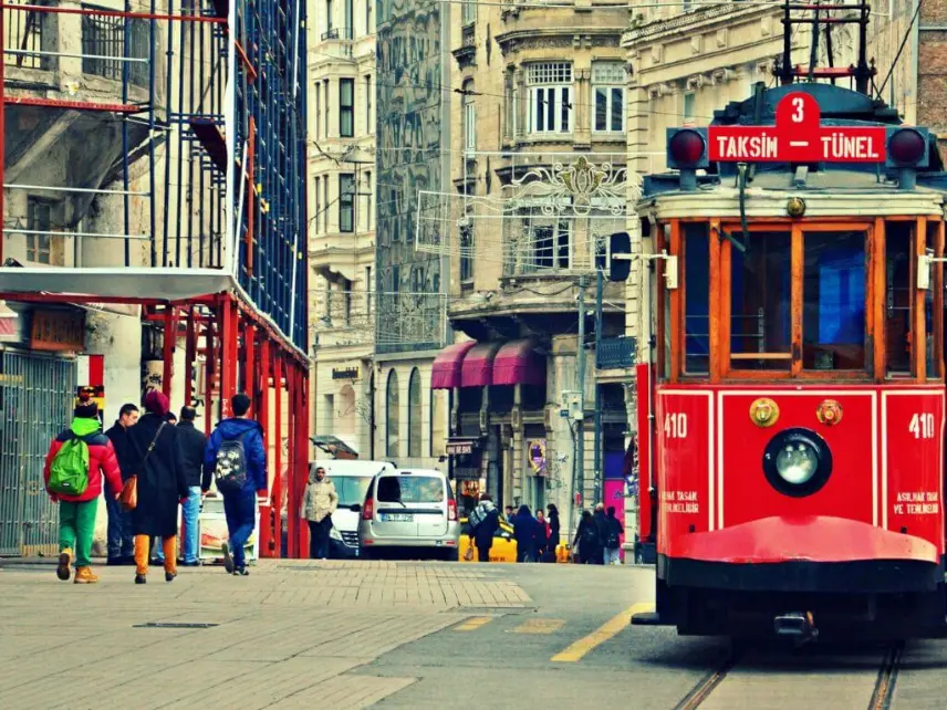
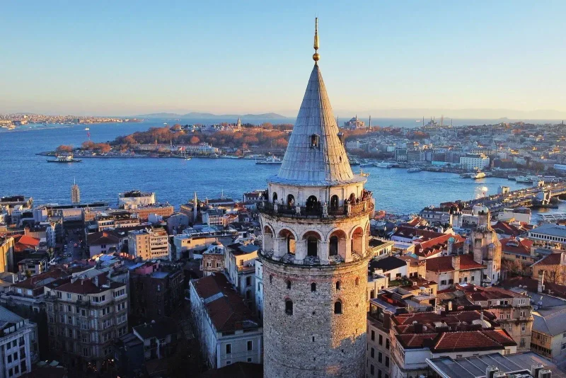
İstiklal Avenue is the main pedestrian street of Beyoğlu, about 1.4 km long, running from Taksim Square down to Tünel Square near the Galata Tower. Because it is closed to traffic, the most useful question is not how to get to İstiklal, but which end of it you need.
Taksim end or Tünel end?
Beyoğlu hotels spread out along both sides of İstiklal and down the hill towards Galata, Karaköy and Cihangir. Arrivals from SAW work best if you aim for the end nearest your hotel.
| Your hotel is near | Aim for | Best public route from SAW | Where a car usually stops |
|---|---|---|---|
| Taksim Square, Gümüşsuyu, Talimhane | Taksim (top end) | Havabus to Taksim | Hotel door or Taksim side streets |
| Cihangir, Galatasaray, Asmalımescit | Middle of İstiklal | Havabus to Taksim, then walk or taxi | Sıraselviler Caddesi or a side street |
| Tepebaşı, Pera, Meşrutiyet Caddesi | Tünel (bottom end) or Şişhane | M4, Marmaray and M2 to Şişhane | Meşrutiyet Caddesi |
| Galata Tower, Kuledibi | Tünel or Karaköy | M4, ferry to Karaköy, Tünel funicular | Şişhane or the lanes below the tower |
| Karaköy waterfront | Karaköy | M4 and ferry to Karaköy | Hotel door on the coast road |
The street is mostly gentle at the Taksim end and steeper towards Tünel, and the lanes below it towards Galata and Cihangir are very steep. Choose your arrival point so that you walk downhill with your bags, not up.
Havabus to Taksim: the direct coach
Havabus is the airport coach company at Sabiha Gökçen. According to its timetable page:
- Fare: ₺485 per person.
- Frequency: every 30 minutes from the airport, 06:30 to 01:30, plus extra services for delayed flights between 01:00 and 04:00.
- Journey time: about an hour and a half, depending on traffic.
- Route from the airport: Kavacık, the Fatih Sultan Mehmet Bridge, 1. Levent, Zincirlikuyu, Dolapdere and Taksim.
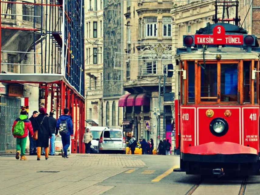
The coach takes the northern bridge, so it misses the worst of the queues on the first bridge, but it still takes longer than a car because of the detour and the stops. From the Taksim stop, the top of İstiklal is a short walk across the square. For hotels in the middle or at the Tünel end, the walk along the pedestrian street with luggage is possible but long; a taxi from Taksim around to Tarlabaşı Bulvarı or Meşrutiyet Caddesi, or the nostalgic tram along İstiklal when it is running, is easier.
By water: M4, the Karaköy ferry and the Tünel funicular
This is our favourite route for travellers with a small bag and a few hours of daylight. It ends right at the bottom of İstiklal and gives you the first view of the city from the water.
- M4 metro to Kadıköy. The airport is one end of the M4 and Kadıköy the other, 23 stations and about 52 minutes away.
- Walk to the Kadıköy pier, a few minutes from the station exit.
- Ferry to Karaköy. Şehir Hatları boats on the Kadıköy-Karaköy-Eminönü line leave Kadıköy every 20 minutes for most of the day in the winter 2026 timetable, and reach Karaköy in about 20 minutes. The last boats from Kadıköy to Karaköy leave around 01:00.
- Tünel funicular up the hill. Opened in 1875, the short underground funicular climbs from Karaköy to Tünel Square in a couple of minutes. You come out at the bottom end of İstiklal, a few minutes' walk from the Galata Tower and the hotels of Pera and Tepebaşı.
Pay for the metro, ferry and funicular with an İstanbulkart, sold from machines in the airport station. There is a second, similar water route to the Taksim end: the Kadıköy-Kabataş ferry, then the F1 funicular from Kabataş up to Taksim Square. Our self-guided Bosphorus ferry guide explains how the city ferries work, and things to do in Galata and Karaköy covers the area where you land.
By rail: M4, Marmaray and the M2 to Şişhane
If it is dark, raining or the ferry gap is long, this route stays underground:
- M4 from the airport to Ayrılık Çeşmesi, one stop before Kadıköy.
- Marmaray west under the Bosphorus to Yenikapı, three stops on.
- M2 north from Yenikapı, over the Golden Horn metro bridge, to Şişhane for the Tünel end and Pera, or one more stop to Taksim.
Şişhane station's exits come up near Meşrutiyet Caddesi, close to the Pera Museum and the hotels of Tepebaşı. The route has no traffic risk, but the Marmaray stations are deep and the change at Yenikapı involves a long walk. On Friday and Saturday nights the M4 and M2 run through the night under Metro İstanbul's night service; Marmaray does not.
By car: tunnel or bridge, depending on the end
A car is the only way to reach the door without carrying bags along a pedestrian street. The driver's route depends on where you are going, which is another reason to send your exact hotel address in advance.
- For Taksim, Cihangir and the top of İstiklal, OpenStreetMap routing takes the 15 July Martyrs Bridge, comes off at Balmumcu, runs down Barbaros Boulevard to Beşiktaş and climbs past Maçka to Taksim. That is about 43 km, with a free-flow time of around 46 minutes.
- For Tepebaşı, Şişhane and the Galata end, the shortest route is through the Eurasia Tunnel under the Bosphorus, along the old city's Atatürk Boulevard and over the Atatürk Bridge across the Golden Horn. That is also about 43 km. The tunnel toll is higher than the bridge toll, and the tunnel occasionally closes for maintenance and events.
Taxis wait at the official rank outside the SAW terminal and run on the meter under the UKOME tariff, which was raised during 2026, with tolls added. Ask for an estimate before leaving and make sure the meter is on. A private transfer uses the same roads at a price fixed in advance for the whole group, with the driver meeting you inside arrivals and a WhatsApp number for delays. Ours starts from $60 per group in a Mercedes Vito, depending on passengers, bags and the hour. Our Istanbul airport private transfer guide explains the meeting point.
Where the car stops. İstiklal itself is closed to cars, as are many of the lanes off it. Drivers use the roads that run parallel: Tarlabaşı Bulvarı on one side, Sıraselviler Caddesi and the Cihangir streets on the other, and Meşrutiyet Caddesi at the Tepebaşı end. Hotels on pedestrian lanes are a short walk from the nearest drop-off, and a private driver will carry bags that last stretch. Around the Galata Tower, the lanes are steep, cobbled and narrow.
The routes side by side
| Route | Ends at | Typical time | Changes | Cost |
|---|---|---|---|---|
| Private transfer | Nearest point to your hotel | 45-90 min | None | From $60 per group |
| Taxi | Nearest point to your hotel | 45-90 min | None | Meter plus toll |
| Havabus | Taksim Square | About 1 h 30 min | None | ₺485 |
| M4 + ferry + Tünel funicular | Tünel Square | About 1 h 30 min to 1 h 45 min | Two | İstanbulkart fares |
| M4 + Marmaray + M2 | Şişhane or Taksim | About 1 h 30 min | Two | İstanbulkart fares |
Car times combine free-flow routing with typical traffic. Public transport times are our estimates from published line times plus changes.
Staying around İstiklal: what arrivals should know
Beyoğlu is the city's centre for nightlife, live music, cinemas, galleries and late dinners. That makes it a good base for evenings, and a noisy one in places.
- Noise. Streets around Asmalımescit, Nevizade and the side lanes off the middle of İstiklal stay loud until late, especially at weekends. If you are a light sleeper, ask for a room at the back or pick Cihangir or the upper Taksim side streets.
- Hills and cobbles. Getting from İstiklal down to Galata, Karaköy or Cihangir means steep streets and stairs. Wheeled cases are hard work; pack accordingly.
- Crowds. İstiklal is very busy on Friday and Saturday evenings. Keep an eye on bags and phones in the crowds, as in any big city centre.
- What is nearby. The Galata Tower and the Pera Museum are at the Tünel end, and Istanbul Modern is down on the Karaköy waterfront. Our İstiklal Avenue and Taksim page covers the street itself.
- Reaching the old city. The T1 tram from Karaköy crosses the Galata Bridge to Eminönü and Sultanahmet, and the M2 from Şişhane crosses the Golden Horn to Vezneciler for the Grand Bazaar.
For a comparison of Beyoğlu with Sultanahmet, Beşiktaş and Kadıköy, see where to stay in Istanbul. Our Istanbul night tour page has ideas for the evenings, and our sister site Get Istanbul Tours has more guided options in the city.
Going back to SAW from Beyoğlu
Havabus leaves Taksim for Sabiha Gökçen every 30 minutes from 03:00 to 22:00, from the Gezi Park metro exit on the square. That covers most early-morning flights, as long as you can walk to Taksim. For pre-dawn departures from the Galata end, a taxi or booked car is easier, and at that hour the drive is often well under an hour. In the daytime, the ferry and metro routes work in reverse. Whichever you choose, follow your airline's check-in advice and allow extra time on weekday afternoons, when traffic towards the Asian side builds early.
Tours that cover this
- Istanbul Airport VIP transfer, private Mercedes Vito to your hotel: from $60 per group.
- Istanbul street food tour through local neighbourhoods: from $90 per person.
- Half-day tour of Yedikule Fortress, Galata Tower and Balat: from $45 per person.
- Private Istanbul tour with a licensed guide, 1, 2 or 3 days: from $199 per group per day.
For food in the area, see our private Istanbul food tour page, or browse all Istanbul tours.
Frequently Asked Questions
How do I get from Sabiha Gökçen to İstiklal Street?
The easiest way is the Havabus coach to Taksim, at the top of İstiklal, every 30 minutes from 06:30 to 01:30 at ₺485. For the lower end, take the M4 metro to Kadıköy, the ferry to Karaköy and the Tünel funicular up to Tünel Square. A taxi or private car takes 45 to 90 minutes.
How far is Sabiha Gökçen Airport from Taksim?
About 43 km by road on OpenStreetMap routing, via the 15 July Martyrs Bridge, with a free-flow time of around 46 minutes. In normal traffic allow 45 to 90 minutes. Havabus, which takes the northern Fatih Sultan Mehmet Bridge and makes stops, gives its own journey time as about an hour and a half.
Can a taxi drive onto İstiklal Avenue?
No. İstiklal is a pedestrian street, and many of the lanes off it are closed to cars too. Taxis and transfer cars stop on the parallel roads: Tarlabaşı Bulvarı, Sıraselviler Caddesi, the Cihangir streets or Meşrutiyet Caddesi near Tünel. From there it is usually a short walk, and a private driver helps with bags.
What is the Tünel funicular?
A short underground funicular, opened in 1875, that links Karaköy on the waterfront with Tünel Square at the bottom of İstiklal Avenue. The ride takes a couple of minutes and saves a steep climb. It is paid with an İstanbulkart and is the natural last leg if you arrive by ferry from Kadıköy.
Is the metro from SAW to Taksim possible?
Yes, with two changes. Take the M4 to Ayrılık Çeşmesi, Marmaray to Yenikapı and the M2 north to Şişhane or Taksim. It avoids traffic but includes deep stations and a long walk at Yenikapı. Marmaray does not run all night, so after midnight use Havabus, a taxi or a booked car.
Is Beyoğlu a good area to stay in?
Yes, if you want restaurants, bars, galleries and evening life on your doorstep. It has good transport links to the old city by tram and metro. The downsides are noise on some streets, steep hills down towards Galata and Cihangir, and big crowds on İstiklal at weekends. Light sleepers should choose a quieter side street.
What time is the last Havabus from Sabiha Gökçen to Taksim?
On the current Havabus timetable, regular departures from the airport to Taksim run every 30 minutes until 01:30, with extra services for delayed flights between 01:00 and 04:00. Timetables can change, so check havabus.com or call 444 26 56 if you land very late.
Should I fly into Sabiha Gökçen or Istanbul Airport for a hotel near İstiklal?
Either works. Istanbul Airport is on the same European side as Beyoğlu, with the M11 and M2 metro and Havaist buses to Taksim. Sabiha Gökçen is on the Asian side, a similar distance away, with a Bosphorus crossing in between. Choose the flight that suits your times and price, and plan the crossing.
Sources: Havabus Taksim-Sabiha Gökçen timetable and fare (havabus.com), Metro İstanbul line list and night metro page (metro.istanbul), M4 line data (Wikipedia, citing Metro İstanbul), Şehir Hatları winter 2026 ferry timetable (sehirhatlari.istanbul), OpenStreetMap routing (OSRM) for distances — checked 6 November 2026.
Private tours in Istanbul
Istanbul Airport VIP Transfer: Private Mercedes Vito to Your Hotel
A private Mercedes Vito takes you door to door from Istanbul Airport to your hotel, or the other way, with a name-sign greeting and live flight tracking.
Istanbul Street Food Tour: Local Neighbourhoods, Baklava and Coffee
Walk through real Istanbul neighbourhoods and markets with a local food guide, tasting street food, baklava, Turkish tea and coffee along the way.
Related guides
- Sabiha Gökçen to Şişli and Nişantaşı: Bridge, Metrobus or Havabus
- Sapanca Day Trip from Istanbul: Lake, Maşukiye Valley and Kartepe
- Sapanca and Masukiye Trip from Istanbul: Distance, Prices, Tips
- Skip the Line in Istanbul: What You Can Really Skip, Tickets, Timing
- Snow in Turkey for Gulf Travellers: Where and When to Go in Winter
- Sprinter Van Transfers in Istanbul for Groups of 7 to 16
- Starting or Ending a Cruise in Istanbul: Planning Your Extra Nights
- Sultanahmet Hotels: Is the Old City the Right Base in Istanbul?
- Things to Do in Balat and Fener: Golden Horn Streets and Churches
- Things to Do in Galata, Karaköy and Beyoğlu: A Walking Route
- Things to Do in Istanbul When It Rains: A Full Day Under Cover
- Things to Do in Istanbul at Night: An Area-by-Area Guide