

 من مطار SAW إلى المدينة القديمة
من مطار صبيحة كوكتشن إلى الفاتح: نفق أوراسيا أو مرمراي أو العبارة من إمينونو
تبعد منطقة فاتح نحو 40 كم عن مطار صبيحة كوكتشن. بالسيارة تستغرق الرحلة 45 إلى 90 دقيقة عبر نفق أوراسيا؛ وبمترو M4 ومرمراي إلى سيركجي أو يني قابي، نحو ساعة ونصف.
استعرض جولاتنا
Fatih is about 40 km from Sabiha Gökçen Airport (SAW) by road, and the drive takes roughly 45 minutes when traffic is light and 75 to 90 minutes at busy hours. Most cars go through the Eurasia Tunnel under the Bosphorus, which comes out on the Marmara shore of the old city. By public transport, the M4 metro and the Marmaray rail line get you there without touching a road, in around an hour and a half with changes. Our private airport transfer does the trip from $60 per group.
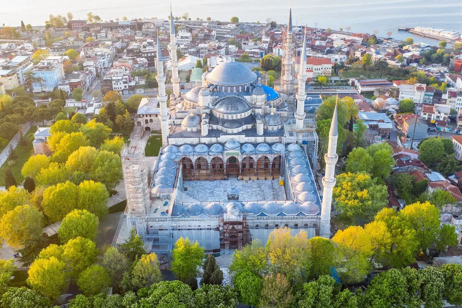
Fatih is not one neighbourhood. It is the whole historic peninsula inside the old land walls: Sultanahmet, Eminönü, Sirkeci, Beyazıt, Laleli, Aksaray, Süleymaniye, the area around the Fatih Mosque, and Balat and Fener on the Golden Horn. Which of these your hotel is in decides the best route, so this page starts there.
Why Fatih is one of the easier runs from SAW
Sabiha Gökçen is on the Asian side, near Pendik and Kurtköy, and Fatih is on the European side. Usually that means a Bosphorus bridge and a slow approach through the city. For Fatih it doesn't, because of the Eurasia Tunnel.
The tunnel is a road tunnel under the Bosphorus, about 5.4 km long, between Göztepe on the Asian side and Kazlıçeşme on the European side. Its European exit lands on Kennedy Caddesi, the coast road along the Sea of Marmara, which runs right around the southern edge of Fatih. OpenStreetMap routing from the SAW terminal gives about 39 km to Laleli and 40 km to the Fatih Mosque this way, with a free-flow driving time of just over 40 minutes. From the coast road the driver turns up into the old city at the gate nearest your hotel.
Two things to know about the tunnel:
- It is tolled, and the toll is higher than the bridge toll. With a taxi the toll is added to the meter. With a fixed-price transfer it should already be in the quote.
- It sometimes closes. The operator closes it for maintenance on some nights and for events. On Sunday 1 November 2026, for example, it was shut in both directions from 06:00 to 15:00. When the tunnel is closed, the driver uses the 15 July Martyrs Bridge and comes down through Beyoğlu and across the Golden Horn instead, which adds distance and time.
Which part of Fatih are you going to?
The district is large enough that "Fatih" can mean a 10-minute walk or a 20-minute drive from the next hotel. This table shows the most practical rail stop and the usual road approach for each area.
| Area of Fatih | What it is like | Nearest rail stop from SAW | Usual road approach |
|---|---|---|---|
| Sultanahmet and Cankurtaran | Hagia Sophia, Blue Mosque, small hotels on steep lanes | Sirkeci (Marmaray), then T1 tram | Eurasia Tunnel, coast road |
| Sirkeci and Eminönü | Station hotels, Spice Bazaar, ferry piers | Sirkeci (Marmaray) | Eurasia Tunnel, coast road |
| Beyazıt and Süleymaniye | Grand Bazaar, university, quieter back streets | Yenikapı (Marmaray), then M2 to Vezneciler | Eurasia Tunnel, then Ordu Caddesi |
| Laleli and Aksaray | Large mid-range hotels, wholesale clothing shops | Yenikapı (Marmaray), then M1A to Aksaray or a short walk | Eurasia Tunnel, then Atatürk Bulvarı |
| Fatih Mosque and Çarşamba | Residential, conservative, local markets | Yenikapı, then M2 to Vezneciler or M1A to Emniyet-Fatih | Eurasia Tunnel or Atatürk Bulvarı |
| Balat and Fener | Boutique guesthouses on the Golden Horn | Eminönü, then T5 tram to Fener or Balat | Golden Horn shore road |
Send your hotel's exact address to your driver: Fatih has several hotels with similar names.
By private car or taxi through the tunnel
With a car, the trip is simple: out of the airport, west along the D-100 on the Asian side, into the tunnel at Göztepe, out at Kazlıçeşme, and along the Marmara shore. The variable is the D-100, which is one of the busiest roads on the Asian side. On weekday mornings and late afternoons, and on Friday evenings, it slows to a crawl in places.
Taxis. There is an official taxi rank outside the terminal, and taxis run on the meter under the city's UKOME tariff, with the tunnel toll added. Istanbul raised its taxi tariff during 2026, so we do not print a lira figure. Ask for an estimate before you set off, check the meter is running, and have the hotel address written in Turkish.
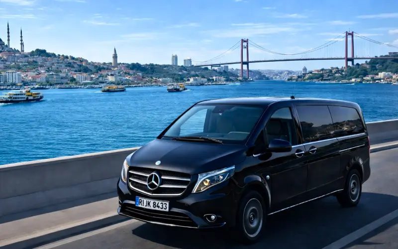
Private transfer. The car takes the same roads, but the price is fixed in advance for the whole group, the driver meets you inside arrivals, and you have a WhatsApp number to message if your flight is late or the queue at passport control is long. Ours starts from $60 per group in a Mercedes Vito; the quote depends on the number of passengers and bags and the hour. Our Istanbul airport private transfer guide explains the meeting point at SAW.
The last few hundred metres. Old city streets were not laid out for vans. In Sultanahmet, Cankurtaran and around Süleymaniye, many hotels are on cobbled, one-way or pedestrian lanes, and the tram line limits where a car can stop. In Balat and Fener the lanes are steep and narrow. The car stops at the nearest legal point and a private driver helps with the bags; a taxi driver may not.
By rail under the Bosphorus: M4 and Marmaray
This is the most reliable public transport route, because it avoids the D-100 completely.
- M4 metro from the airport. The airport station is the last stop on the M4, which runs 23 stations to Kadıköy. Ride it towards Kadıköy as far as Ayrılık Çeşmesi, the second-to-last station.
- Change to Marmaray at Ayrılık Çeşmesi. Marmaray is the suburban rail line that crosses under the Bosphorus. Take a train heading west, towards Halkalı.
- Get off at Sirkeci or Yenikapı, depending on the table above. Sirkeci is the first stop on the European side, deep underground below the old station area. Yenikapı is one stop further and is the big interchange for the M1A, M1B and M2 metro lines.
- Finish by tram or metro. From Sirkeci, the T1 tram runs uphill to Gülhane, Sultanahmet, Çemberlitaş, Beyazıt and Laleli. From Yenikapı, the M2 goes one stop to Vezneciler (for Süleymaniye and the Grand Bazaar), and the M1A goes to Aksaray and Emniyet-Fatih.
Pay with an İstanbulkart, the city travel card, sold from machines at the airport station. The whole M4 line takes about 52 minutes end to end, and you get off one stop short, so allow roughly 1 hour 15 minutes to 1 hour 40 minutes to the hotel door, depending on the changes. Expect long escalators at the deep Marmaray stations.
On Friday and Saturday nights, Metro İstanbul runs the M4 and M2 through the night as part of its night metro service. Marmaray is not part of that service, so after midnight this route does not work.
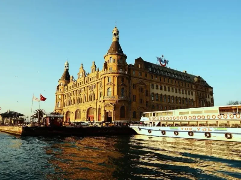
By ferry: M4 to Kadıköy and the boat to Eminönü
With light bags in daylight, this is the most enjoyable way in: you see the old city skyline from the water first.
- Ride the M4 all the way to Kadıköy, about 52 minutes.
- Walk a few minutes to the Kadıköy pier.
- Take the Şehir Hatları ferry to Karaköy and Eminönü. In the winter 2026 timetable, boats leave Kadıköy every 20 minutes for most of the day; the first stop is Karaköy after about 20 minutes, and Eminönü comes a few minutes later. After about 20:30 the boats run to Karaköy only, so later arrivals should take Marmaray.
- From the Eminönü pier, the Spice Bazaar and the New Mosque are in front of you, Sirkeci is a short walk east, and the T1 tram stops at Eminönü for Sultanahmet. For Balat and Fener, the T5 tram runs from Eminönü along the Golden Horn.
The ferry is paid with the same İstanbulkart. Our guide to the Bosphorus ferry without a tour explains how the city boats work, and the Galata Bridge and Eminönü page describes where you land.
Comparing the routes
Coaches help less here. The main Havabus line runs to Taksim, on the wrong side of the Golden Horn for most of Fatih: every 30 minutes from the airport, 06:30 to 01:30, at ₺485 on its timetable page. It is a late-night fallback, with a taxi from Taksim to finish. Havabus also lists a Yenikapı line from the İDO pier, but with departures only every 90 minutes and no published airport-to-Yenikapı times, so check with Havabus (444 26 56) before relying on it.
| Route | Typical time to the hotel | Changes | Cost | Works after midnight? |
|---|---|---|---|---|
| Private transfer | 45-90 min | None | From $60 per group | Yes |
| Taxi | 45-90 min | None | Meter plus tunnel toll | Yes |
| M4 + Marmaray + tram or metro | About 1 h 15 min to 1 h 40 min | Two | İstanbulkart fares | No (Marmaray stops) |
| M4 + ferry to Eminönü | About 1 h 30 min or more | Two | İstanbulkart fares | No |
| Havabus to Taksim + taxi | About 2 h | One | ₺485 plus taxi | Yes, until 01:30 departures |
Car times combine free-flow routing with typical Istanbul traffic; the rail times are our estimates from the published line times plus transfers.
Arriving in Fatih: what to expect
Fatih is the most historic part of Istanbul and, away from the Sultanahmet hotel strip, one of the most traditional.
- Sultanahmet is quiet at night once the day visitors leave, and almost everything worth seeing is within walking distance: Hagia Sophia, the Blue Mosque, Topkapı Palace and the Basilica Cistern. Our Sultanahmet hotels guide covers the lanes where most small hotels are.
- Laleli and Aksaray have many larger, good-value hotels, because the area is a wholesale clothing district. The streets are busy with traders and vans by day and quieter at night. Transport links are good: the T1 tram and the M1A metro both stop here.
- Beyazıt and Süleymaniye put you between the Grand Bazaar and the Süleymaniye Mosque. Most streets are steep.
- Around the Fatih Mosque, the neighbourhood is residential and conservative. The Fatih Mosque is surrounded by a large street market on Wednesdays, which fills the streets around it, so a car will struggle to get close that day. Dress modestly in these streets.
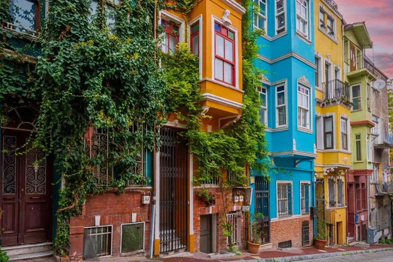
- Balat and Fener have restored wooden and brick houses, cafés and small guesthouses, plus the Fener Greek Orthodox Patriarchate. See our Balat guide and the Balat and Fener page.
For a side-by-side look at Fatih against Beyoğlu, Beşiktaş and Kadıköy, read where to stay in Istanbul.
Going back to Sabiha Gökçen from Fatih
Many SAW departures are early in the morning, and that is when public transport is thinnest. Marmaray does not run through the night, and outside Friday and Saturday nights neither does the M4, so for a dawn flight, book a car or a taxi. At that hour the tunnel route is quick, often well under an hour.
For a daytime flight, the Marmaray route works in reverse: Sirkeci or Yenikapı to Ayrılık Çeşmesi, then the M4 to the airport. Follow your airline's advice on check-in time and allow extra for the D-100, which is heaviest heading east in the late afternoon.
Tours that cover this
- Istanbul Airport VIP transfer, private Mercedes Vito to your hotel: from $60 per group, from SAW or Istanbul Airport.
- Istanbul old city morning highlights, small group: from $120 per person.
- Half-day Istanbul tour of Ottoman sites: from $88 per person.
- Half-day tour of Yedikule Fortress, Galata Tower and Balat: from $45 per person.
You can see the full range on our Istanbul tours page, or start with our Istanbul destination guide.
Frequently Asked Questions
How far is Sabiha Gökçen Airport from Fatih?
About 40 km by road. OpenStreetMap routing gives 39 km to Laleli and 40 km to the Fatih Mosque through the Eurasia Tunnel, with a free-flow time of just over 40 minutes. In normal traffic allow 45 to 90 minutes. Balat, on the Golden Horn, is slightly further, at around 42 to 48 km depending on the route.
Does the car use a bridge or the tunnel from SAW to Fatih?
Usually the Eurasia Tunnel, which runs under the Bosphorus and exits at Kazlıçeşme on the Marmara coast road, right below the old city. It is tolled and costs more than the bridges. When the tunnel is closed for maintenance or an event, drivers use the 15 July Martyrs Bridge and cross the Golden Horn instead.
What is the best public transport from Sabiha Gökçen to Fatih?
The M4 metro to Ayrılık Çeşmesi, then Marmaray under the Bosphorus to Sirkeci or Yenikapı. From Sirkeci the T1 tram serves Sultanahmet, Beyazıt and Laleli; from Yenikapı the M2 and M1A serve Süleymaniye, Aksaray and the Fatih Mosque area. Allow about 1 hour 15 minutes to 1 hour 40 minutes in total, with an İstanbulkart.
Can I take a ferry from Sabiha Gökçen to the old city?
Yes, with the M4 first. Ride the M4 to Kadıköy, walk to the pier and take the ferry to Karaköy and Eminönü, which leaves every 20 minutes for most of the day in the winter 2026 timetable. Eminönü is served until about 20:30 to 21:00; later boats stop at Karaköy only.
Is there a Havabus from Sabiha Gökçen to Sultanahmet or Fatih?
Not a practical one. The main Havabus line goes to Taksim, every 30 minutes from 06:30 to 01:30, at ₺485. Havabus also lists a Yenikapı line, but it has few departures and its airport-to-Yenikapı times are not published on the line page. For Fatih, Marmaray or a car is better.
How much is a taxi from Sabiha Gökçen to Fatih?
It is metered under Istanbul's UKOME tariff, plus the Eurasia Tunnel toll. The tariff was raised during 2026, so we do not give a figure; ask the driver for an estimate before leaving and make sure the meter is on. A pre-booked car with us starts from $60 per group, agreed in advance.
Can a car reach my hotel door in Sultanahmet or Balat?
Not always. Many hotels in Sultanahmet, Cankurtaran, Süleymaniye and Balat are on narrow, cobbled, one-way or pedestrian lanes. The car stops at the nearest point it legally can, often a minute or two's walk away, and a private driver helps carry your bags. Ask your hotel where cars usually drop off.
Is Fatih a good area to stay in?
Yes, especially for a first visit. Sultanahmet puts the main monuments within walking distance, Laleli and Aksaray have good-value hotels with tram and metro links, and Balat suits travellers who want a quieter, more local feel. Nightlife is limited compared with Beyoğlu, and the area around the Fatih Mosque is conservative.
Sources: Havabus timetables and fares (havabus.com), Metro İstanbul line list and night metro page (metro.istanbul), M4 line data (Wikipedia, citing Metro İstanbul), Şehir Hatları winter 2026 ferry timetable (sehirhatlari.istanbul), Eurasia Tunnel operator notices (avrasyatuneli.com), OpenStreetMap routing (OSRM) for distances — checked 6 November 2026.
جولات خاصة في إسطنبول
نقل VIP من مطار إسطنبول: مرسيدس فيتو خاصة إلى فندقك
سيارة مرسيدس فيتو خاصة تنقلك من باب إلى باب من مطار إسطنبول إلى فندقك أو العكس، مع استقبال يحمل اسمك وتتبع مباشر للرحلة الجوية.
جولة آيا صوفيا للمجموعات الصغيرة مع تذكرة دخول والمسجد الأزرق والبازار
الهيبودروم والمسجد الأزرق وآيا صوفيا والبازار الكبير في مجموعة صغيرة، مع الاستلام من الفندق في وسط المدينة وتذاكر الدخول مشمولة.
مرشدات ذات صلة
- من صبيحة كوكشن إلى قاضي كوي: مترو M4 وهافابص والتاكسي أو السيارة الخاصة
- من مطار صبيحة كوكتشن إلى السلطان أحمد: مسار النفق وخطوات القطار ونصائح سيارات الأجرة
- رحلة يومية إلى سابانجا من إسطنبول: البحيرة، ووادي ماشوكيي، وقرطبة
- تجاوز الطوابير في إسطنبول: ما الذي يمكنك فعلاً تجاوزه والتذاكر والتوقيت المناسب
- الثلج في تركيا للمسافرين من الخليج: أين ومتى تذهب في الشتاء
- ما يمكن فعله في بالات وفنر: شوارع القرن الذهبي والكنائس
- أشياء للقيام بها في غلطة وكاراكوي وبيوغلو: مسار للمشي
- أشياء تفعلها في إسطنبول عند هطول المطر: يوم كامل في الداخل
- ما يمكن فعله في إسطنبول ليلًا: دليل حسب المنطقة
- ما يمكن فعله في كاديكوي: موداي، شوارع الأسواق والجانب الآسيوي
- أشياء للقيام بها في السلطان أحمد: معالم المدينة القديمة بترتيب المشي
- جولة إرشادية في قصر توبكابي: الحرم والخزينة وتذاكر 2026